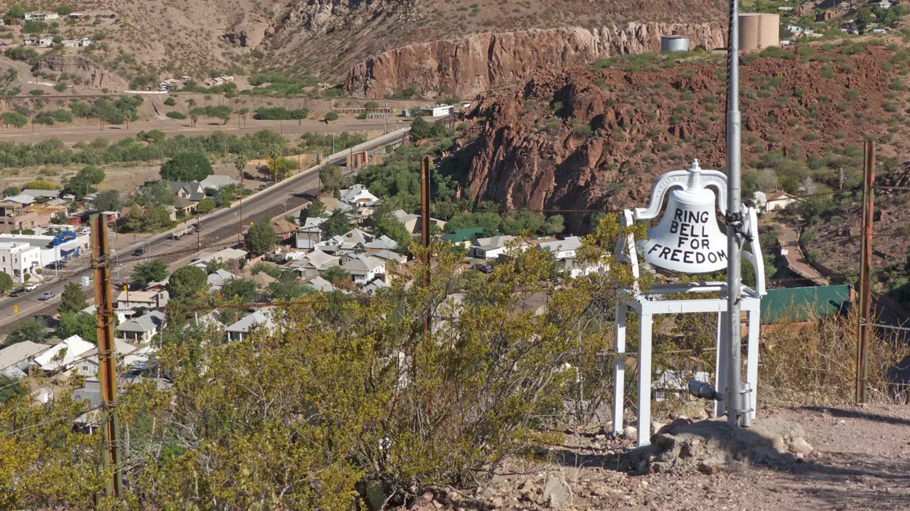
Just a half mile from town is a short, steep hike that leads to a spectacular view of downtown Clifton and the surrounding mountains. Friends and relatives of those who served have hung replica "dog tags" on wire cables, representing more than 1700 veterans from all branches of the military. Along the route, plaques commemorate those service men and women from Greenlee County who were killed in action or are missing in action.
The idea for the memorial came from a U.S. Army veteran who served in Vietnam, and it was built by veterans and members of the community to serve as a place of reflection and healing.
More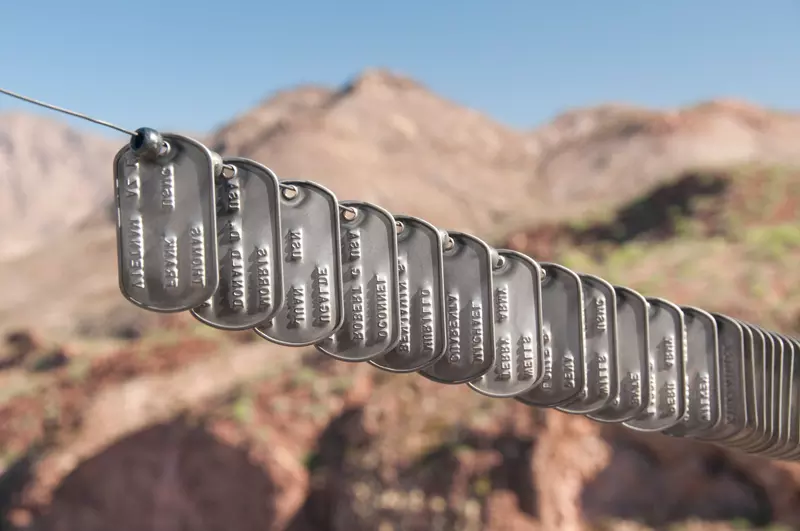
Directions:
Take Wards Canyon Road .4 miles and look for the signed parking lot on your left. The hike is approximately 6.5 miles round trip, with an elevation gain/loss of 350 feet. A cool morning is the best time to climb, and be very careful of your footing, especially on the way down.
ea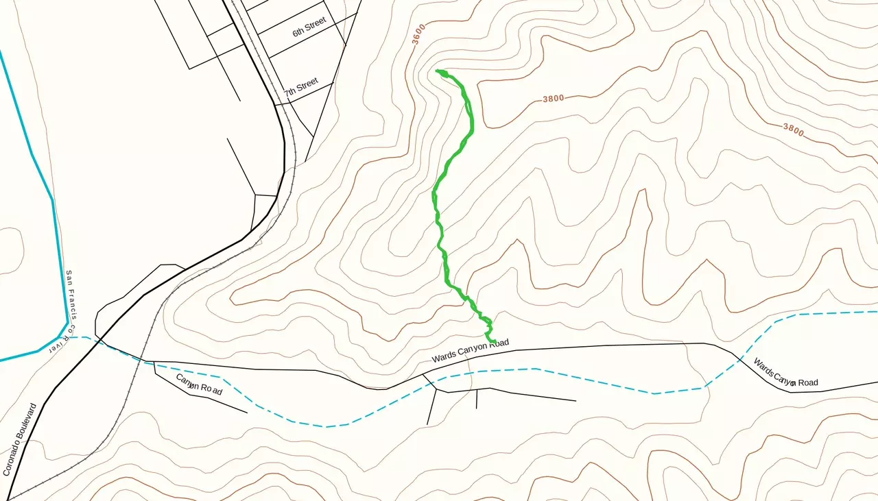
The Grand Enchantment Trail is a 770+ mile wilderness route that travels from Phoenix to Albuquerque through the most ruggedly beautiful mountains of Arizona and New Mexico. Segment 14 of the trail passes very close to Clifton, following Eagle Creek north to the San Carlos Indian Reservation. Clifton is an important resupply point, and local trail angels happily provide assistance through-hikers and cyclists, including transportation to and from the trail, hot showers and free or very inexpensive accommodations. Your Clifton contact is Jeff Gaskin (520-508-3321 or suriname09[at]gmail.com). In nearby Safford, astride the Southern Tier Bike Route Jay Rasco (928-235-1861 or jyrasco1936[at]gmail.com) is a member of the Warm Showers Community, providing free worldwide hospitality exchange for touring cyclists.
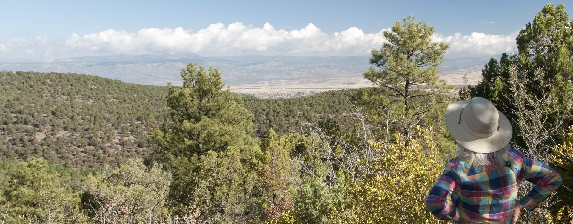
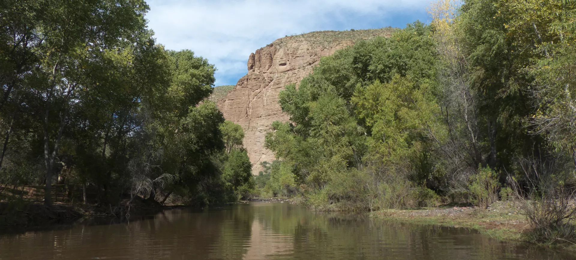
Eagle Creek is also a great destination for day hikes or multi-day backpacking trips. It's renowned not only for its steep-walled canyons, but for its remarkable history. The creek flows year 'round, but its water is borrowed from another watershed far to the north. Water from the Black River in northern Arizona is pumped up 700 feet to the rim of the Black Canyon, gravity-fed 6½ miles into Willow Creek and then transported 21 miles to Eagle Creek, where it flows downstream 30 miles to a pumping station that supplies water to the mines in Morenci.
Access to the creek requires a sturdy 4WD high clearance vehicle and please check the stream flow before crossing.
This trail winds for 12½ miles, dropping over the edge of the Mogollon Rim to descend all the way to Eagle Creek. 3,617 feet accumulated elevation gain. This trail includes collapsed mines, springs, pyrite (fool's gold), and Eagle Creek at the end. There are petroglyphs on Painted Bluff, about 500 feet above the trail. There's a small parking lot at the trailhead aear milepost 177 on the Coronado Trail.
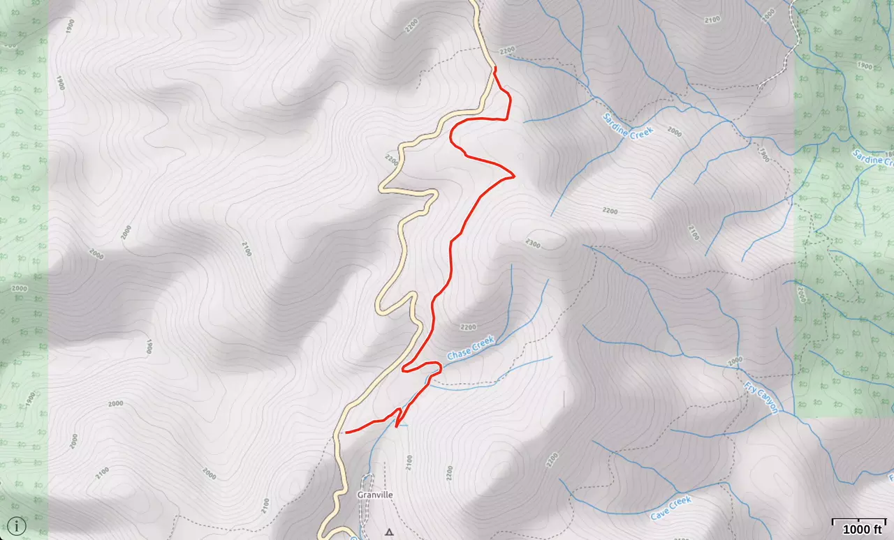
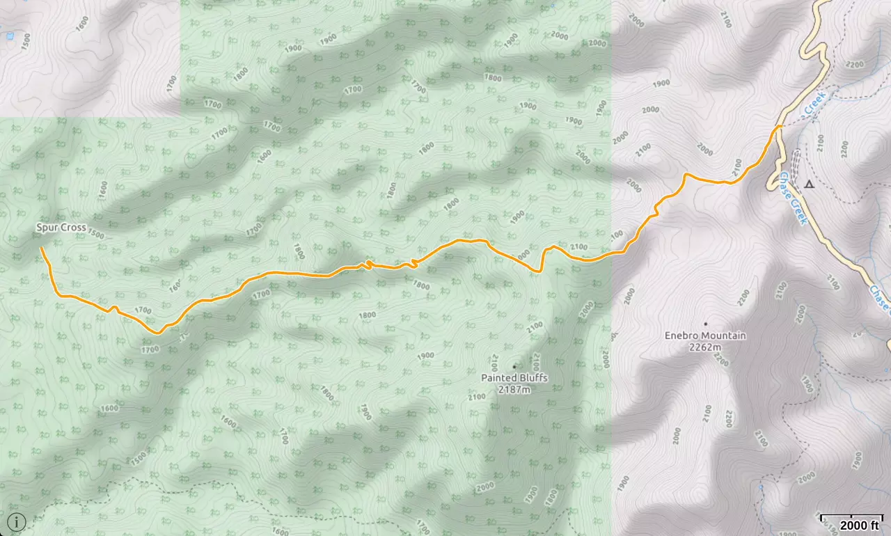
Sardine Saddle Trail follows the old route of Route 666/191 from Granville Campground, paralleling the road, to reach Sardine Saddle in three miles.
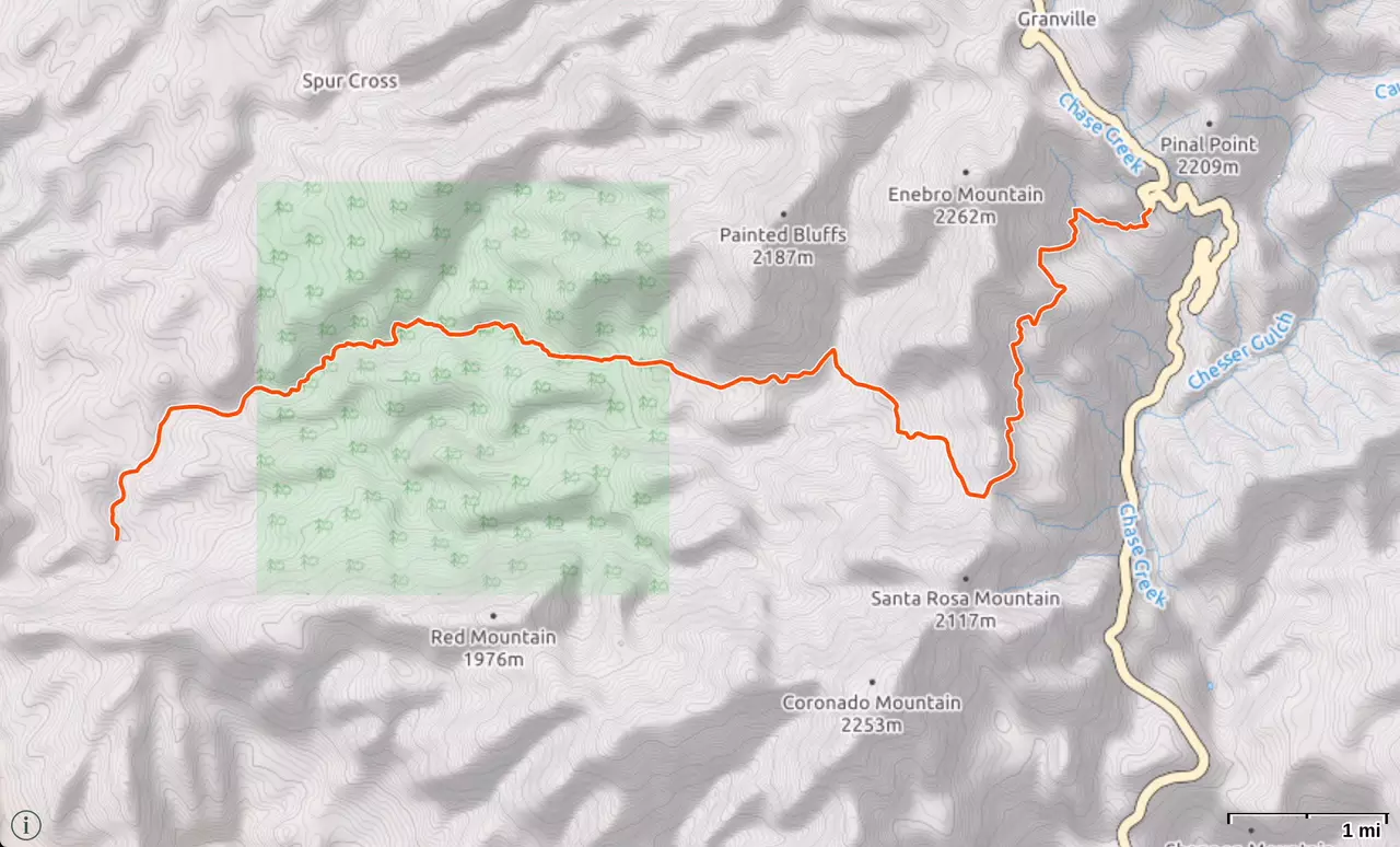
The Spur Cross Trial is a 5.8 mile one way hike with 3,373 feet accumulated elevation gain. This ridgeline trail travels through pinyon/cypress forest to access the old Spur Cross homestead. A small cave about 4 miles down shows signs of pre-historic use. The trailhead is located on the west side of US 191 near milepost 179.
The lightly used HL Canyon Trail takes off from the east side of US 191 near HL Saddle. It's a loop hike of approximately eight miles in length that wraps around Mitchell Peak (elev. 7951), passing by a historic cabin said to have been built by a rancher who sold beef to the miners of the Clifton area.
More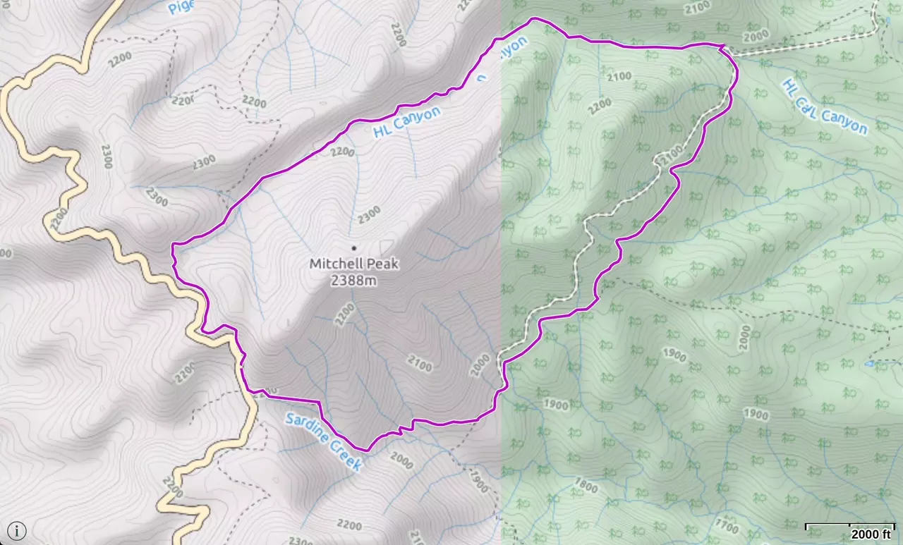
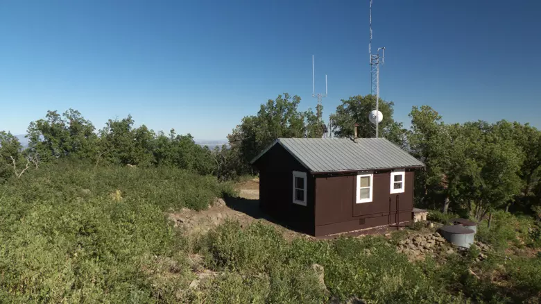
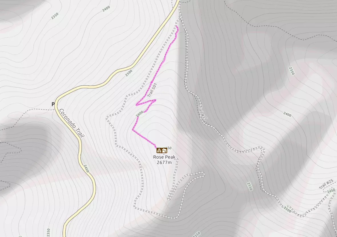
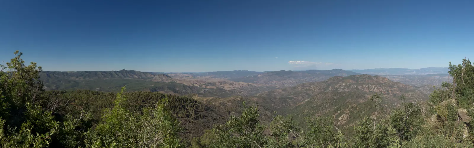
About 45 miles north of Morenci, trail 501 leads .82 miles to a fire lookout atop Rose Peak. The trail splits off to the left about 100 feet up the road, and takes a more direct and probably somewhat shorter path to the summit. This hike has a huge payoff for little effort. The trails starts out in a dense pine forest and climbs into an old burn area now nicely overgrown with young oak trees. The trail is in great shape and is obviously maintained. Switchbacks up the steeper sections and forest opens up to mind-blowing views in all directions. At the summit you'll find a bare, stony ridge with a beautiful 30-foot-tall fire tower, cozy cabin and a pit toilet.
The Rose Peak Lookout was built in 1929 to replace several earlier wood platform towers. The original 12' x 12' cabin was replaced in 1981 with a 14' x 14' live-in cabin with a catwalk.
Trailhead Elevation: 8426 feet
Elevation Gain: 360'
Trail Length: 1.64 miles round trip